museum-digitalrheinland-pfalz
CTRL + Y
en
"dc-r" docu center ramstein Dreidimensionale Objekte [DCR2013_0023_01]
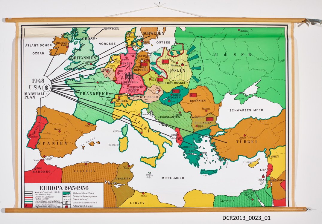
Landkarte, Wandkarte, Europa 1945-1956 ("dc-r" docu center ramstein CC BY-NC-SA)
Provenance/Rights: "dc-r" docu center ramstein (CC BY-NC-SA)
1 / 1 Previous<- Next->

Landkarte, Wandkarte, Europa 1945-1956

Contact Cite this page Data sheet (PDF) Calculate distance to your current location Archived versions Mark for comparison Graph view

Description

Die Wandkarte zeigt welche Staaten vom Marshall-Plan profitiert haben. Sie hat den Titel EUROPA 1945-1956 und gehört zu einem Konvolut Schulkarten aus der ehemaligen Hauptschule von Ramstein-Miesenbach.

Material/Technique

Papier, Druck, Holz, Metall.

Measurements

H 100 cm; B 160 cm

"dc-r" docu center ramstein

Object from: "dc-r" docu center ramstein

„Ramstein, Germany“ ist durch seinen US-Flugplatz weltweit ein Begriff. Das benachbarte Kaiserslautern kennt man in der Welt als „K-Town“. Seit bald...

Contact the institution

[Last update: ]

Usage and citation

The textual information presented here is free for non-commercial usage if the source is named. (Creative Commons Lizenz 3.0, by-nc-sa) Please name as source not only the internet representation but also the name of the museum.
Rights for the images are shown below the large images (which are accessible by clicking on the smaller images). If nothing different is mentioned there the same regulation as for textual information applies.
Any commercial usage of text or image demands communication with the museum.